
One of the reasons that I was reluctant to go to the Outback was that I wasn’t excited about seeing Uluru. Uluru is also known by the name given to it by the Europeans, Ayer’s Rock. I always thought it was just a big, stupid rock so who cares. Maybe you’ll actually think that when you see my pictures, but let me tell you, it’s impressive. I think one of the problems is that the pictures don’t do its size justice. It’s the world’s largest monolith and it’s in the middle of a completely flat area. It’s 343 meters/1.150 feet high, 3.6 kilometers/2.2 miles long and 2.4 kilometers/1.5 miles wide. It’s eight kilometers/five miles in circumference. Uluru means meeting place and it’s home to many sacred Dreamtime legends. The color of the rock appears to change throughout the day with the sunrise and sunset. The rock is thought to be 600 years old and like an iceberg only a small fraction is visible while the rest of it is underground. Geologists think that the roots might go down as far as 6000 meters/20,000 feet. Needless to say my feelings about the “big, stupid rock” changed after seeing it in person. It is truly impressive!
We got to Uluru in time for the sunset on Saturday and then we stayed until midday on Monday so we had time for two sunsets, two sunrises, and two long hikes as well. We also had some free time so some people went skydiving, some went camel riding, and I went for a helicopter ride. We also got a chance to relax by the pool which was quite nice. The Outback can get up to 45°/113°F, but we got lucky and it was never above 35°C/95°F.
Our tour guide took us on a cultural walk where he talked about some of the locations on the rock that are sacred to the Aboriginals. After that we did the base walk around the rock which is about 2.5-3 hours. We could have also climbed to the top of the rock. While there is a way to get up, the Aboriginals ask that people don’t climb it because the rock is sacred to them. Not only that, but the climb is quite dangerous. It’s actually closed often due to winds or if the temperature is over 36°C/97°F. The climb is open in general because they are afraid that people will stop coming if it’s closed. There is a cultural center which explains the Aboriginals ties to Uluru and why they prefer that people don’t climb it. In the cultural center there is also a book called the Sorry Book which contains letters from people all over the world who have regretted climbing the rock. People have written letters explaining they believe their bad luck is a consequence of climbing the rock. People have even sent back rock or piles of sand they took and asked the rangers to return them it the proper location. It’s a pretty powerful book. There’s also a spot for people to pledge why they won’t climb it.
Near Uluru is also Kata Tjuta which means many heads. It’s actually 36 boulders shoulder to shoulder forming deep valleys adn steep-sided gorges. The tallest rock, Mt. Olga, is 200 m/656 ft higher than Uluru. We did the 7.4 km/4.6 mile hike through the Valley of the Winds.

Uluru at sunset

Uluru at sunrise

Uluru during the day with my tour group

There are places at the rock that are only for women and some that are only for men. Each gender is not supposed to see the other gender’s special place. Because of this, they asked that we don’t take pictures because then they may end up on social media and an Aboriginal would see something that s/he shouldn’t. It already happened in the 70s when a man was looking through a National Geographic and saw a picture of a place at the rock that was designated only for women.

View of the top of the rock from the helicopter.

View of the desert from our helicopter ride

View of Uluru and Yulara, the nearby town.

View of Uluru from a helicopter ride

View of Uluru from a helicopter ride

View of Uluru from a helicopter ride

All set for the helicopter ride!

Having a blast with Anna on the helicopter

Yeah, we survived the helicopter ride

The path to climb to the top of Uluru. There’s a chain to hold on to since it’s so step. Our guide said that the top of the part we can see is only 1/3 of the way to the true top.

View of Uluru from our walk around the bottom.

View of Uluru from our walk around the bottom.

Kata Tjuta from the helicopter

Kata Tjuta at sunrise
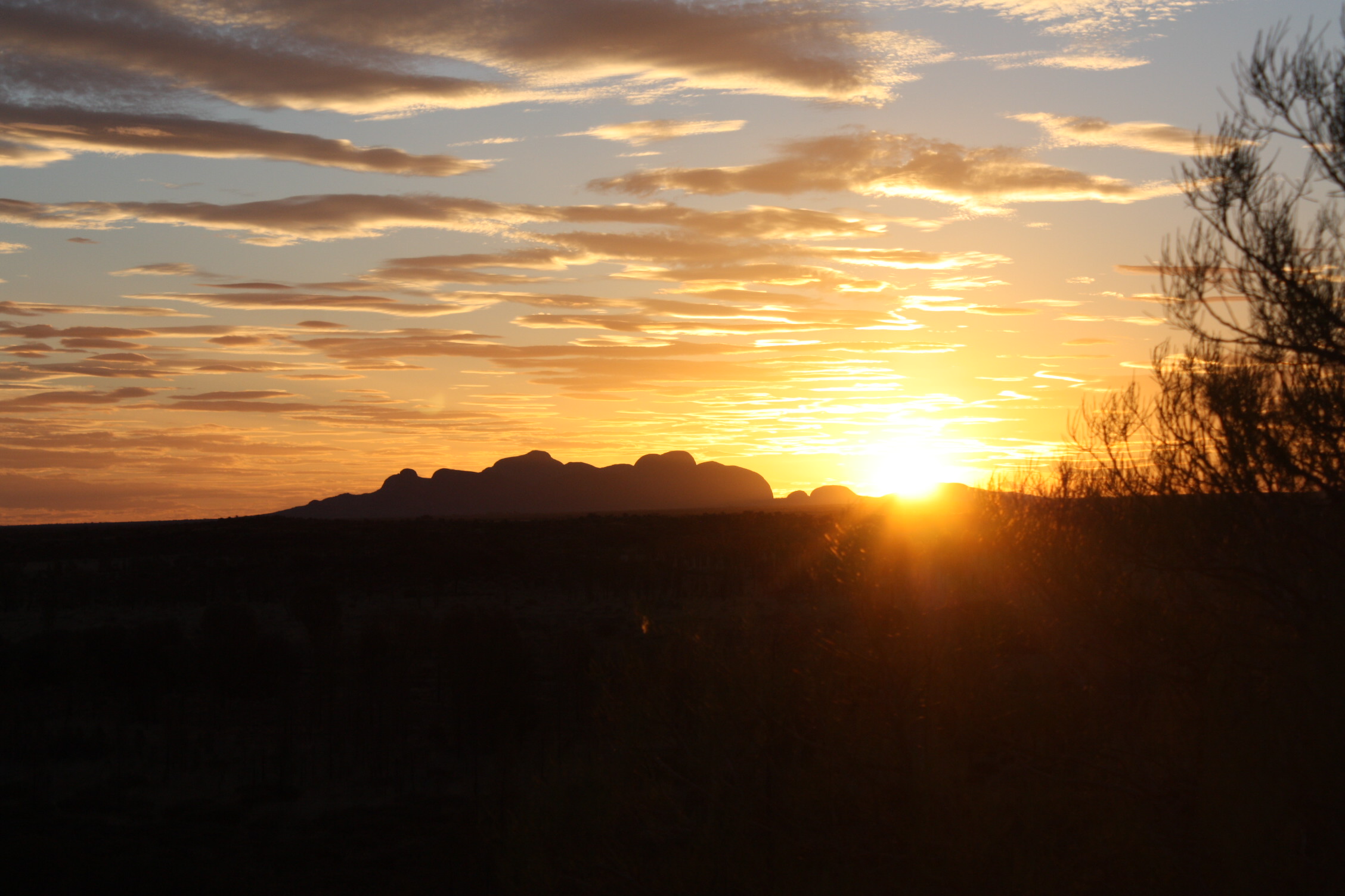
Kata Tjuta at sunset

Hike through the Valley of the Winds at Kata Tjuta

Our tour group at Kata Tjuta

While at Uluru, we slept in swag; a waterproof canvas sleeping bag with a foam pad for comfort.

The outback goes on for thousands of kilometers!
3 Comments
hi jennie, great pictures from your helicopter flight. uluru impressed me as well. when i look at these pics i can’t believe i have been there. i’m happy to do this tour with you 🙂
Awesome pictures and great views from the top. Never done the helicopter ride but would love to next time 🙂 Great read…. It would also be great to know how did you get to Ayers Rock? Via Alice Springs?
Hi Melissa, I did a tour with a company called Groovy Grape. It was the Rock Patrol Tour and it was 5 days leaving from Adelaide and ending in Alice Springs although you could do it the other way. http://www.groovygrape.com.au/our-tours/tours/rock-patrol–1